

Ostrovy Thajska
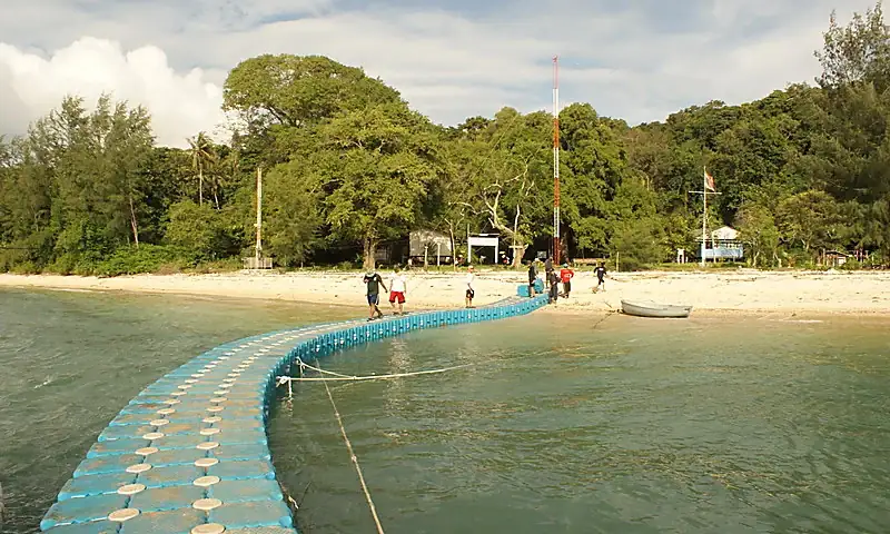
Koh Tapao Noi
Co potřebujete vědět
Navy-managed Koh Tapao Noi s majákem a doloženým návštěvnickým landing/conservation kontextem; není modelován jako běžný veřejný ferry ostrov.
Navy/Hydrographic-managed T3 – před cestou ověřit povolení a loď
Royal Thai Navy documentation proves tourist-purpose boat landing infrastructure, but is historical evidence of the pier, not a 2026 walk-up/open-now guarantee.
Jaký typ cesty se hodí na Koh Tapao Noi
Hodí se pro
Počasí a moře
Live provider zatím není připojen. V administraci Ostrovy → Live data lze vložit WeatherAPI klíč.
Koh Tapao Noi
Jak se na ostrov dostat
Navy-managed/arranged visitor boat access. Historical Navy sources document landing infrastructure, but no unrestricted public ferry timetable is inferred.
Rizika a co ověřit před cestou
Kdy jet a co znamená monzun
Historický a komunitní kontext
Royal Thai Navy installed a floating pier to facilitate boat docking and interested tourists landing on the island; this remains historical infrastructure provenance, not a current access guarantee.
T3 permission/current-operation dependent
Current management permission, pier status and boat operation must be checked before travel.
Šnorchlování a korály
No exact current Koh Tapao Noi reef-health/visibility binding is stored.
Příroda, fauna a zajímavosti
Royal thajský námořnictvo conservation-cestovní ruch kontext includes coral-protection infrastruktura. Historical pontoon/buoy infrastruktura is not assumed to be physically unchanged in 2026 without aktuální confirmation.
Co nebrat jako samozřejmost
Hydrographic lighthouse/Navy presence is established. Historical floating pontoon is a dated baseline, not a current-condition guarantee.